
How the Nautical δ-Corridor Ensures Safe Autonomous Ship Navigation
We compile, generate and translate using Artificial Intelligence from the below given source. Macro Micro News is responsible for its editorial publication.
Switzerland, Source:
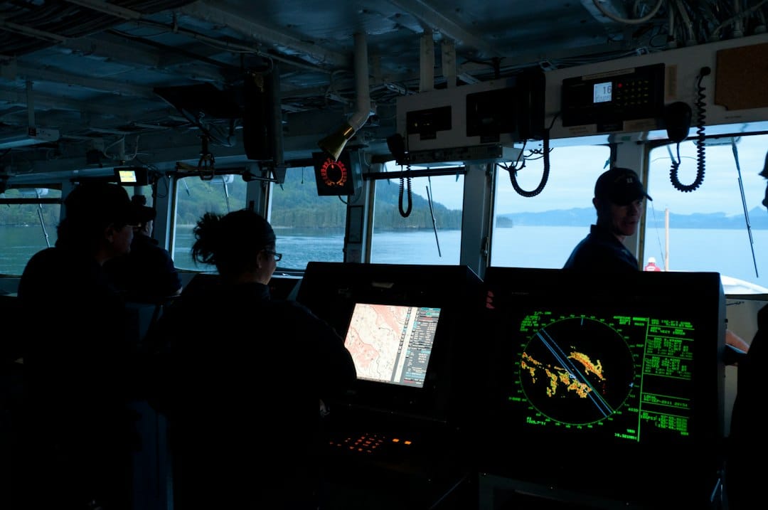
The maritime industry stands at a pivotal moment as autonomous surface ships move from experimental phases to regulated commercial deployment. A critical challenge remains: ensuring navigational safety while strictly adhering to international collision regulations. Researchers have introduced the 'Nautical δ-Corridor,' a novel framework designed to provide connectivity-preserving and depth-admissible paths for unmanned vessels. This innovation addresses fundamental limitations in traditional route-planning algorithms that typically output a single optimal track without accounting for the surrounding water space necessary for emergency maneuvers.
Traditional grid-based planners often fail because they treat only the central line as safe. Maritime collision regulations require vessels to make positive, large-scale deviations to avoid collisions, necessitating substantial lateral space to stop and turn. The δ-corridor solves this by constructing a structured subset of navigable water around a reference track. It ensures that every cell within the corridor satisfies strict under-keel clearance policies based on the vessel’s dynamic draft, tidal conditions, and squat allowance. This guarantees that any local maneuver executed within the corridor is physically safe from grounding.
The framework employs a multi-phase construction process. Phase 1 expands the track into a navigable band using latitude-compensated metrics to ensure physical accuracy across different chart resolutions. Phase 2 prunes dead-end structures to maintain topological connectivity. Crucially, Phase 3 applies rigorous geometric and topological filters. It removes narrow access pockets that could trap a vessel and eliminates single-cell articulation points that could disconnect the corridor if a specific area becomes unavailable. This results in a robust workspace where local controllers can search for collision avoidance paths at high speeds without repeatedly checking bathymetry.
A key feature of the δ-corridor is its asymmetric design, which allocates more width to the starboard side. This aligns with COLREGs preferences for starboard alterations during head-on or crossing encounters. Experiments across ocean, archipelago, and harbor scenarios demonstrate that this directional allocation significantly improves the feasibility of large-angle maneuvers in constrained waters, even when the total corridor area remains constant compared to symmetric models. Furthermore, the method ensures scale invariance. Specifying width in nautical miles rather than grid cells allows the corridor to maintain consistent physical dimensions regardless of chart resolution.
While the current implementation uses simplified kinematic models for testing, the δ-corridor provides a hard spatial constraint layer that can interface with advanced dynamic control systems. By moving grounding risks from objective functions to immutable constraints, this technology paves the way for safer, more efficient, and fully autonomous global shipping operations. The integration of such precise spatial awareness marks a significant step forward in reducing human error and enhancing operational reliability in complex maritime environments.
Related in Gadgets

Gadgets
How SMHA Solves the AI Image Quality Puzzle: A New Framework for Precision
The surge in text-to-image generation has reshaped digital creation, yet it brings a pressing question: how do we truly measure the quality of these synthetic visuals? Traditional photos face physical issues like blur or noise, but AI-generated images present a more complex land…
Read More...
Gadgets
How AI Stops Cyberattacks in P2P Energy Markets: Real-Time Detection Explained
The smart grid is undergoing a profound transformation. We are moving away from centralized power plants toward decentralized networks where energy flows bidirectionally. This shift relies on integrating information technology with physical infrastructure. Modern grids now facil…
Read More...
Gadgets
How to Cool EV Motors: The 31% Efficiency Gain in PMSM Design
The push for electric vehicles is accelerating at a rapid pace. This shift brings a significant engineering hurdle to the forefront. Thermal management in permanent magnet synchronous motors has become a critical challenge. Modern drivetrains generate intense heat. This heat con…
Read More...
Gadgets
How AI-Driven RIS on High-Altitude Platforms Boosts Energy Efficiency for IoT
Global, Source In remote rural areas and disaster zones Internet of Things devices often face a frustrating reality weak or blocked connections to terrestrial base stations. This connectivity gap creates significant hurdles for critical applications such as environmental monitor…
Read More...
Gadgets
How Real-Time Iteration NMPC Solves Offshore Wind Turbine Control in Under 5 Milliseconds
Offshore wind turbines equipped with full-power converters face a complex control challenge that requires the simultaneous coordination of power tracking, electrical safety, and mechanical load mitigation. While Nonlinear Model Predictive Control offers a systematic framework fo…
Read More...
Gadgets
How L1* Regularization Transforms Multi-Modal Anomaly Detection: A New Standard for Semantic Accuracy
In a world where data streams from countless sources, traditional anomaly detection often struggles to keep pace. Most existing algorithms rely on single-modal inputs like text or images alone, missing the intricate correlations that define real-world scenarios. This limitation…
Read More...
Gadgets
How Deep Learning Keeps Remote Solar Security Systems Online
Maintaining uninterrupted surveillance in remote locations presents a unique engineering challenge. Unlike urban infrastructure powered by stable electrical grids, solar-powered security systems rely entirely on intermittent renewable energy sources and finite battery storage. A…
Read More...
Gadgets
How Failure-Guided Control Boosts Au-Wire Bonding Strength by 3x on Silicon Submounts
As programmable photonic integrated circuits expand to support higher port counts and system-level reconfigurability, high-density electrical fan-out has become a critical packaging bottleneck. In the realm of silicon photonics, particularly for devices like optical field-progra…
Read More...
Gadgets
FSA-Net: How Deep Learning Pinpoints Unknown Signal Sources with Sub-Degree Precision
Imagine trying to locate multiple whispers in a noisy room without knowing how many people are speaking or where they stand. This is the daily reality for engineers working with wireless communications and radar systems. Traditional tools like MUSIC and ESPRIT have long been the…
Read More...
Gadgets
DyMC-YOLO: How Dual-Stream Fusion Boosts Real-Time Detection to 46 FPS
Object detection stands as a fundamental pillar of intelligent visual perception. It powers critical advancements in autonomous driving, security surveillance, and precision agriculture. Yet traditional visible-spectrum detectors often falter under adverse conditions like low il…
Read More...