
Coastal Damage Revealed: How NOAA Aerial Data Tracks Isaias Impact
We compile, generate and translate using Artificial Intelligence from the below given source. Macro Micro News is responsible for its editorial publication.
Washington, United States, Source:
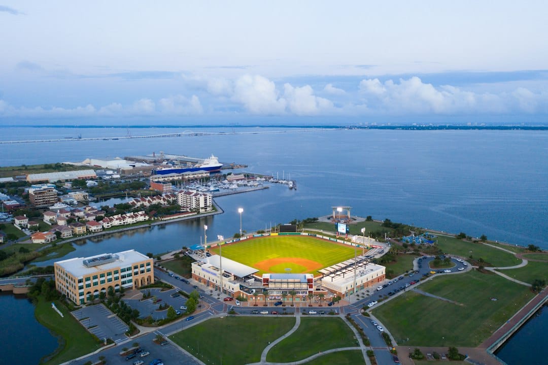
The National Geodetic Survey has opened its digital archives to the public, offering a clear window into the aftermath of Hurricane Isaias. These aerial images, captured by NOAA aircraft, provide a detailed look at how coastal regions fared during the storm. The data was gathered through close coordination between NOAA, FEMA, and various state and federal partners, ensuring that every vulnerable area received attention.
Access to this Emergency Response Imagery is now live, with fresh updates appearing as soon as they are processed. The collection spans from October 10 through October 13, creating a chronological record of the assessment process. This systematic approach allows researchers and officials to track changes over time, providing a comprehensive view of the storm's immediate effects on the landscape.
These images serve a purpose far beyond simple documentation. They act as critical tools for safe navigation, helping mariners identify new hazards in waterways and ports. By comparing pre-storm baseline data with current conditions, authorities can accurately measure damage to infrastructure and communities. This comparison is essential for planning recovery efforts and understanding the long-term environmental shifts caused by the hurricane.
Aerial imagery offers a cost-effective way to evaluate both property and environmental damage. It enables rapid assessment of large geographic areas, which is vital for timely disaster response. The high-resolution photos help determine the severity of structural damage, map erosion patterns, and note changes in land use. All these details are crucial for directing relief operations effectively and efficiently.
NOAA’s role extends well beyond immediate disaster response. As the primary U.S. Government source for precise latitude, longitude, and elevation measurements, it maintains the accuracy of national geographic data. The fleet of ships and aircraft supports diverse missions including weather forecasting, oceanographic research, and emergency response. This robust capability ensures that accurate information is available when decision-makers need it most.
The availability of these images underscores the value of advanced technology in modern disaster management. By leveraging aerial surveillance, agencies can make informed decisions about resource allocation and recovery strategies. The data collected contributes to a broader scientific understanding of hurricane impacts, helping to improve future preparedness and resilience efforts across the nation.
Related in Scientific Research
Scientific Research
Why PLOS Climate's Digital Shift Matters for Global Policy Makers
The landscape of scientific publishing is shifting beneath our feet. Accessibility is no longer just a nice-to-have feature but a critical component in shaping global policy and public understanding. When we look at the digital infrastructure supporting major journals like those…
Read More...
Scientific Research
PLOS Climate 404 Errors: What Broken Links Reveal About Open Science's Future
The digital landscape of academic publishing is shifting beneath our feet. Researchers and students frequently hit a wall when trying to access vital climate science literature. The familiar 'Page Not Found' error appears on major open-access platforms like PLOS Climate. This HT…
Read More...
Scientific Research
Why Climate Science Links Are Breaking: The Open Access Challenge You Need to Know
The digital world of academic publishing moves fast. For groups like PLOS that push for open access, keeping research visible and easy to find is everything. They work hard to make sure scientists, leaders, and the public can get important info without barriers. But even the bes…
Read More...
Scientific Research
Chicago 2027: OHA and AFS Unite for a Landmark Oral History Gathering
The Oral History Association has officially confirmed the details for its 2027 Annual Meeting. This event marks a significant collaboration in historical preservation and cultural studies. The gathering will take place from November 3 to November 6, 2027, in Chicago, Illinois. I…
Read More...
Scientific Research
Maine's Bluff Crisis: How New Data Is Saving the Coastline
Maine’s coastline defines the state’s character with over 5,000 miles of shoreline that hold immense ecological and economic value. Yet this beauty masks a growing vulnerability. Nearly half of the state’s shore consists of coastal bluffs that face increasing instability from er…
Read More...
Scientific Research
PLOS Climate: How Open Access is Reshaping Global Warming Solutions
In the fast-paced world of scientific publishing, transparency and accessibility have become essential drivers for meaningful progress. The Public Library of Science (PLOS), a nonprofit organization based in California, stands at the forefront of this movement. While technical g…
Read More...
Scientific Research
Climate Science in the Digital Age: How Open Access is Reshaping Global Research
In an era where climate change stands as the defining challenge of our time, the dissemination of scientific knowledge has become as critical as the research itself. The digital landscape of academic publishing is undergoing a profound transformation, driven by the urgent need f…
Read More...
Scientific Research
Why Broken Links in Climate Science Matter More Than You Think
In the fast-paced world of digital science, finding a paper is only half the battle. Getting to it matters just as much. Organizations like PLOS work hard to keep knowledge open and free. But what happens when that door slams shut? A recent "Page Not Found" error on the PLOS Cli…
Read More...
Scientific Research
Pacific Climate Shifts: How Kelvin Waves Drive El Niño Patterns
Beneath the vast expanse of the Pacific Ocean, a quiet force is orchestrating some of the most significant climate shifts on Earth. These are not the crashing surf that draws tourists to the shore but rather slow-moving disturbances of warm water stretching thousands of miles ac…
Read More...
Scientific Research
How PLOS Climate Is Reshaping Global Policy Through Open Science
The landscape of scientific publishing is shifting rapidly. Open access journals are no longer just an alternative; they are becoming the primary engine for democratizing knowledge and accelerating responses to environmental challenges. PLOS Climate stands at the forefront of th…
Read More...